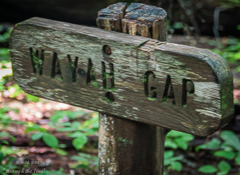
A couple of days ago we went to hike the Wayah Gap to Siler Bald trail in the Nantahala National Forest. It is a small day hike that is part of the Appalachian Trail. The trail head is located a few miles outside of Franklin, NC on Wayah Road. This hike would have had us headed south but for some reason when we got there we decided to go north towards the WayahTower.
We parked alongside the road and headed up the trail. It started with and continued for a ways with a series of deep steps on a sharp incline. These types of trail steps are often created either from wooden beams with a dirt fill, stones to climb or roots growing in such a way as to make steps. As I started, my mind wandered to how the AT came into being and how it is maintained. I later researched the internet for information and found the trail history goes back to 1921 and a man named Benton MacKaye. Over the years the plans for the trail changed a little and support between private citizen groups and the government grew until the AT was granted federal protection and became a national scenic trail. It continues to be maintained through the efforts of the Appalachian Trail Conservancy , National Park Service, and the United States Forest Service.

Path through the trees
The first part of the trail was hard for me. My age and problems with breathing (along with a couple of other conditions) set boundaries that I must respect while at the same time I continue to push against. After a while the path became easier with intermittent difficult spots. We did not hike the trail to the tower but it took me about an hour and forty-five minutes to travel about 1.8 miles. That was around half the distance to the tower. Fortunately, I have a very patient hiking partner. During that time our ascent was eight hundred feet. So the total trip was three hours with eight hundred feet up and then down. To put that in perspective for myself, that is like climbing the stairs to my second floor, up and down, a hundred times in three hours. Probably best I don’t look at it that way.

Appalachian Trail sign
The path was quiet and peaceful. The crowns of the trees formed a canopy that protected us from both the sun and the occasional rain that fell. Wild flowers were abundant and filled the path with color. We were passed by a couple of young thru-hikers shortly after we had started. We chatted for a few minutes and they were on their way. I have a lot of respect for people who hike or even attempt to hike the 2200 mile trail. According to the Appalachian Trail FAQ’s it takes from five to seven months to complete the trail and about twenty percent of the people who start, finish it. Based on my couple of AT day hikes I have completed approximately 0.681818% of the trail and those two hikes were some of the hardest I have done. Hum, like I said, a lot of respect.

Tree gutted by fire
All along the trial was evidence of the forest fires last fall. There were a number of these fires burning at the same time in North and South Carolina, Tennessee and Georgia. From everything I have read these were all started by people and made worse by the drought and windy weather conditions. The people who fought these fires are examples of the unsung heroes that live among us. They risk their lives for little pay and next to no recognition. As we were driving through the Nantahala Forest I saw a sign that stated ninety percent of all forest fires are man-made. They can come from a cigarette carelessly tossed from a car, trash or camp fires during a drought or being set intentionally by someone. Regardless of the cause, the cost is high in natural resources, money, property and lives.
As we walked we noticed how the trail seemed to follow the National Forest Road that we later used to drive to the Wayah Tower. I had always thought the AT was totally remote except when crossing a road, but now I wonder how often it follows a road or highway. Close to two miles into the hike we came to where the AT again crossed the road. We had to make a decision whether to continue or go back. We chose to go back. Part of the decision was based on my feeling tired but a bigger part was base on the fact we really had no map past that point. When we hike I use the app Gaia GPS. Prior to the trips I lay out the section we will travel and download it to the phone. I am able to use it to guide us. Since the plan had been to hike south I only had so much of the north trail downloaded. I had started to bring a paper map but had decided not to at the last minute. Hopefully, some day, I will learn.
When we arrived back at the car we decided to drive to the tower. The road was a pretty typical for a service road. It was a lot of packed gravel with many pot holes. Along the way were more visuals of the destruction of the fires.

View from top of Wayah Bald

Charred remains of post
We parked at the top and the view was spectacular even though the day was cloudy with some mist. In spite of the weather conditions we were able to see for thirty to forty miles. The stone tower was still standing but the roof was gone leaving only a couple of charred pieces of wood on steel rods to show where the post once were. I found the juxtaposition of the burn to the stone structure and the surviving trees and plants sad and yet enlightening in a way. Nature was dealing with her scars and rebounding. There was much green and new growth mixed in with and surrounding the burned trees.
On the drive down we stopped at the Wilson Lick Ranger Station.The house was built in 1916 and was the first ranger station in the new Nantahala National Forest. In the 1940’s a garage was added. There was also an outhouse still standing. The house and garage were locked which was sad but understandable. Some of the century old structures we have visited up here have been defaced by people with the strong urge to leave their name or message engraved or painted on the walls.

Home site at Wilson Lick Ranger Station

Information board at Wilson Lick Ranger Station
Imagining the peace and quiet that living here must have brought is offset by the thoughts of the challenges and difficulties the folks must have faced. There was no running down to the corner minute mart for milk. No doctor when you were sick and no instant connection to the outside world. I gives me pause to reflect on how easy my life is and how much I take for granted.
I am glad that gratitude has stopped being simply a feeling and has become a way of life.
“Nature was dealing with her scars and rebounding”. As do we all. Beautiful writing as always, Jim.
So true, as do we all.